
Pocomoke Sound Corridor Resiliency Framework
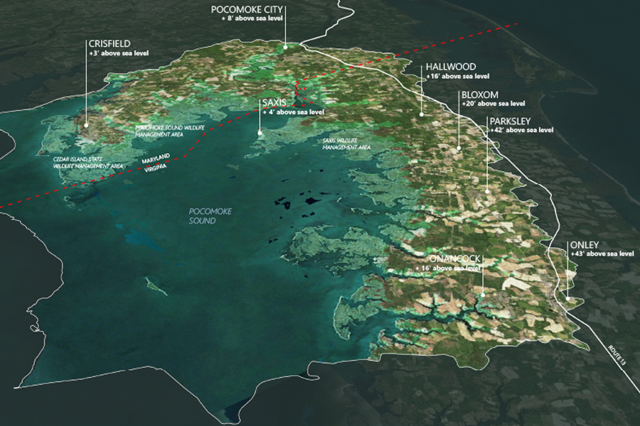
The Pocomoke Sound Corridor Resiliency Framework is a high level, forward-looking landscape scale plan that addresses ecosystem and community resiliency and adaptation as sea level rises and flooding increases within the region. Led by The Nature Conservancy, the Framework Is an important first step intended to spur future phases will incorporate community engagement, identify specific […]