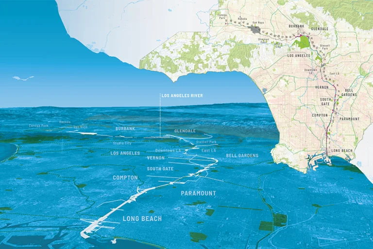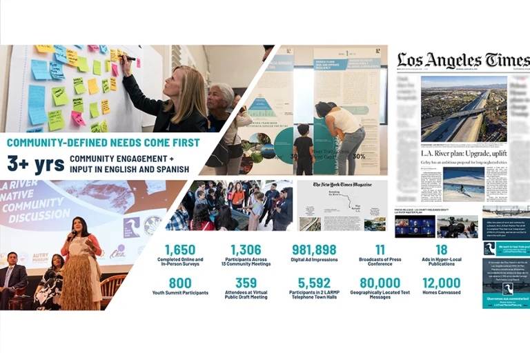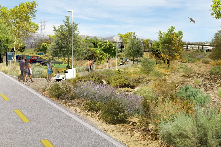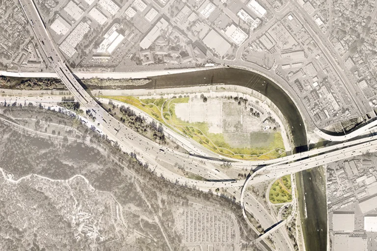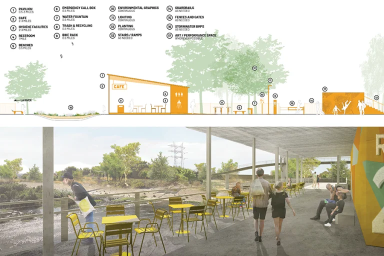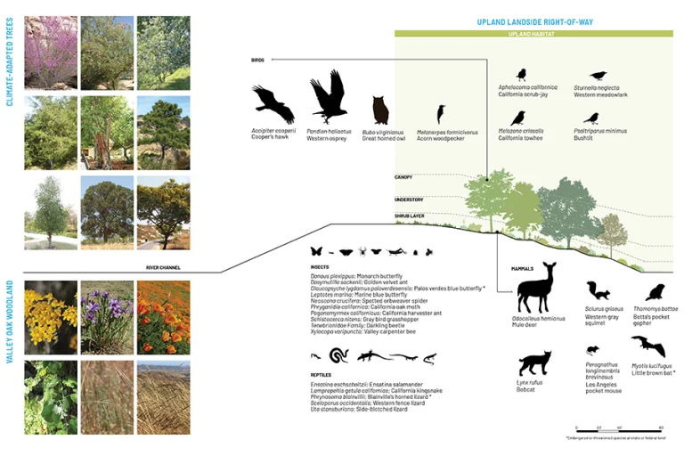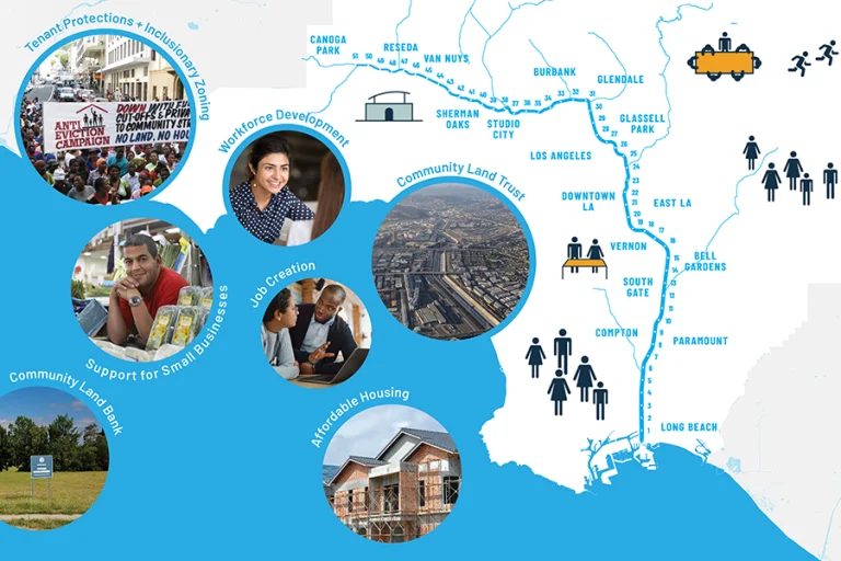
OLIN worked with Geosyntec, Gehry Partners, Street Level Advisors, and River LA on the update of the LA River Master Plan. Through an extensive public engagement process and close collaboration with LA County, the update modernizes the 1996 blueprint and investigates opportunities for recreation, social equity, public health, and flood mitigation. This new, unified vision for the 51-mile corridor reconnects the river to the diverse communities of LA County and to one another, while addressing significant flooding risks along the river corridor. The plan seeks to leverage infrastructure to address systemic issues faced within the county without dictating a one-size-fits-all solution for the full 51 miles. In addition to conducting the most comprehensive assessment to-date of this diverse watershed, the team developed a detailed suite of design guidelines to holistically guide the buildout of proposed interventions. The guidelines document addresses access points to the newly designated public realm along the river’s edge, new facilities and park amenities, consistent, yet site-specific native plant palettes, and a unified trail network with a signage and wayfinding system that meets established criteria across each jurisdiction along the river.
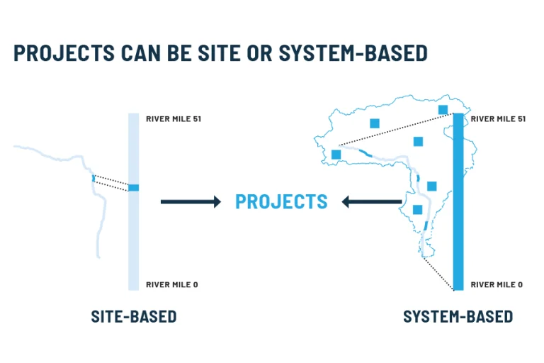
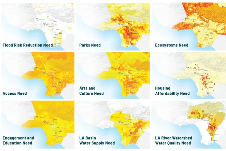
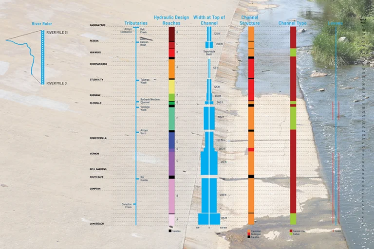
The Master Plan is built around a data-based methodology in which over 200 datasets related to water, people, and the environment were analyzed in a comparable format of the “river ruler” for decision making. Nine goals, derived from a robust community engagement process, drive decision making for projects and policy.
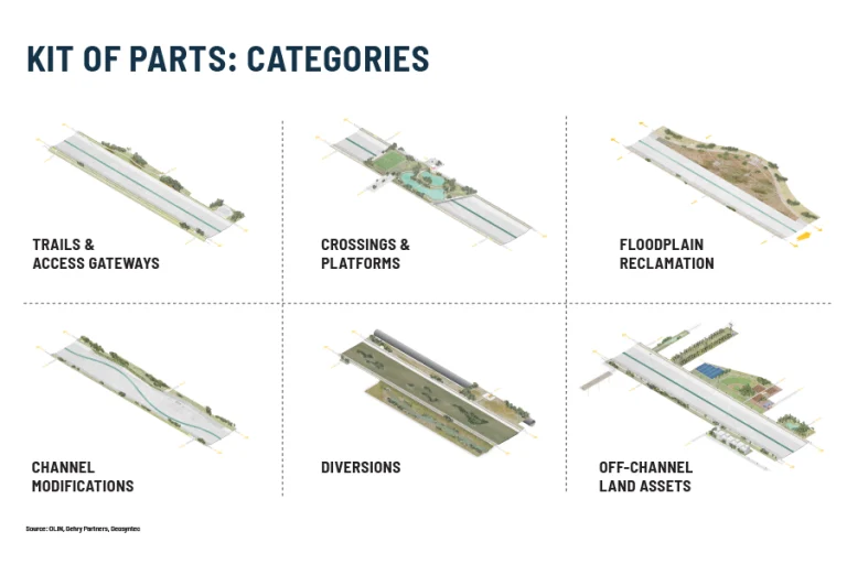
In order to understand the potential intervention types along the LA River, the plan utilizes a kit of parts that includes possible design strategies for sites along the river. Each strategy is linked to which goals the component can address. Plans for common elements, such as river pavilions or environmental graphics, are included for consistency along the river.