
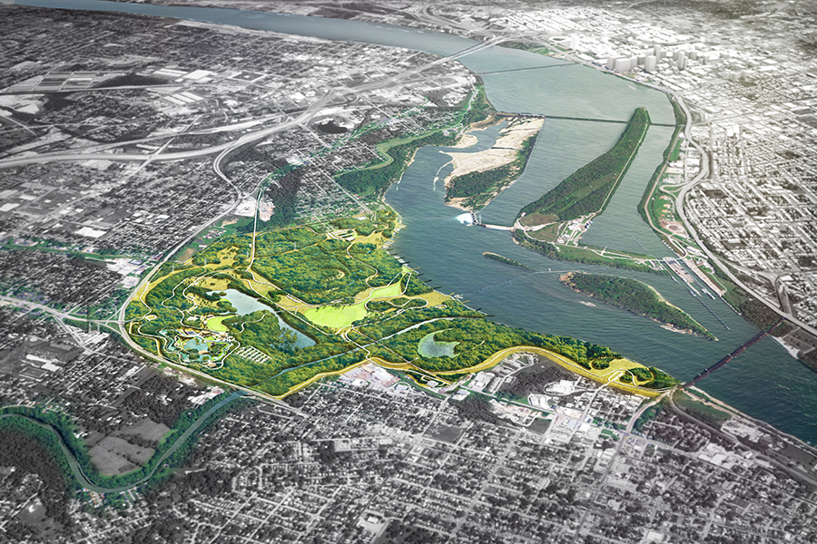
Green Over Gray
Cleveland is in a moment of profound transition. Following decades of industrial decline, population loss and proliferation of abandoned lots, parts of Cleveland are beginning to come back, guided by sound institutions, a burgeoning health care industry, nonprofit and philanthropic partnerships and local citizens. Initiatives such as Re-Imagining Cleveland have already helped reveal creative solutions […]
Pocomoke Sound Corridor Resiliency Framework
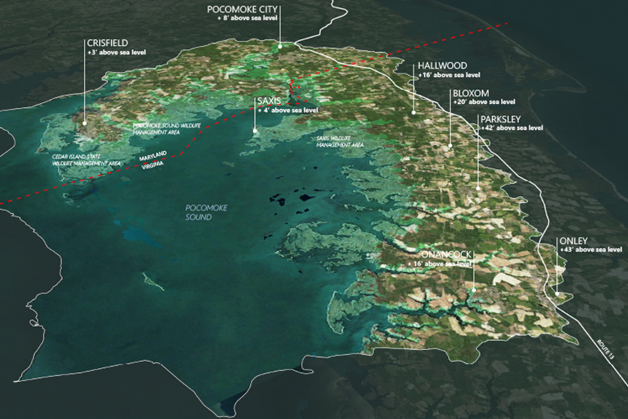
The Pocomoke Sound Corridor Resiliency Framework is a high level, forward-looking landscape scale plan that addresses ecosystem and community resiliency and adaptation as sea level rises and flooding increases within the region. Led by The Nature Conservancy, the Framework Is an important first step intended to spur future phases will incorporate community engagement, identify specific […]
Hunts Point Lifelines
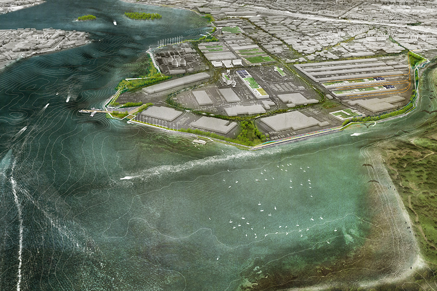
The Hunts Point Lifelines project is an innovative plan to safeguard the hub of New York’s Food Supply through a protective and resilient landscape infrastructure. The plan was a funded winner of the U.S. Department of Housing and Urban Development’s Rebuild by Design competition. The project is an exemplar of design that demonstrates innovative, scalable […]
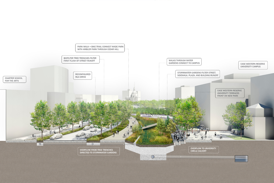
Mill River Park and Greenway
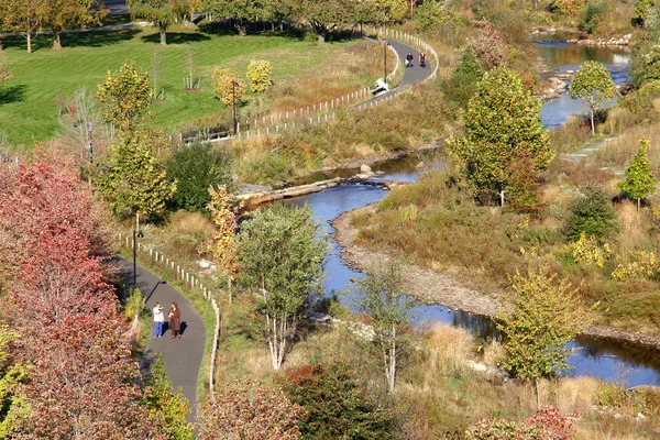
For decades, Mill River in Stamford, Connecticut was dammed and channelized, choked with pollution and silt buildup, leading to greater flood risk for the surrounding downtown. When the Army Corps of Engineers called for the removal of the dam and channel walls, OLIN was brought in to create a master plan for the newly naturalized […]
Origin Park
OLIN has been commissioned to develop a design for a new 400-plus acre park in Southern Indiana, along the northern shore of the Ohio River. The project will rehabilitate and transform an expanse of waterfront lands, which for decades have been occupied with landfills and industrial facilities, into a rich cultural and civic asset for […]
ResilienCity Park
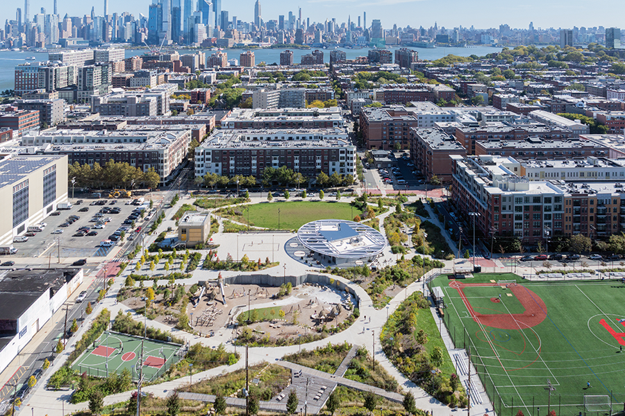
ResilienCity Park is Hoboken’s largest park, providing recreation and public space while serving as landscape infrastructure that manages almost two million gallons of stormwater in a low lying, flood-prone city. The park transforms an asphalt covered, former industrial site into a vegetated public space filled with amenities for the Hoboken community. Through a robust engagement […]
Red Hook Housing Restoration
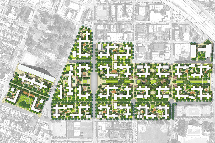
OLIN is a core design and planning member of the Red Hook Housing restoration plan led by Kohn Pedersen Fox. During Hurricane Sandy, residents lost heat, power, and in some cases water, with many stranded in their apartments or unable to return for weeks. The storm permanently damaged the majority of the electrical and heating […]
Master Plan for the Central Delaware
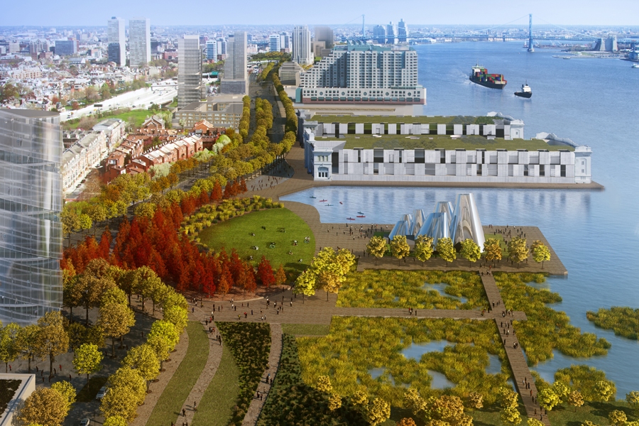
This master plan is a 25-year roadmap to transform the post-industrial lands along the Delaware River into a vibrant urban waterfront. OLIN focused on enhancing the urban ecology of Philadelphia in order to promote social equity and economic well-being. The plan proposes providing access to public parks at half-mile intervals along the entire 6-mile length […]
Robert F. Wagner, Jr. Park
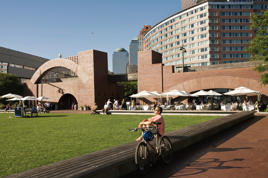
Robert F. Wagner, Jr. Park was the final and southernmost waterfront park to be developed in accordance with the 1978 Battery Park City Master Plan. OLIN was fueled by a desire to break from traditional garden design and make the park reflective of New York City at the end of the 20th century. The landscape […]
Caño Martín Peña Comprehensive Infrastructure Master Plan
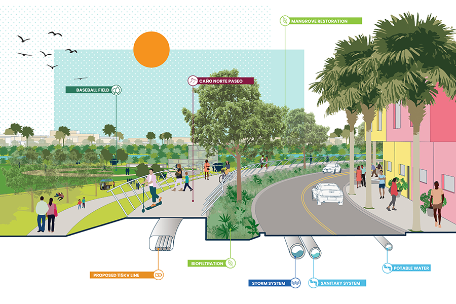
The one square mile District of Caño Martín Peña is located between Luis Muñoz Marín International Airport and the resorts of the Condado District and Downtown San Juan. The district sits along the Martín Peña channel, a narrow body of water that connects the Bay of San Juan with the San José Lagoon. This unique […]