
Green Over Gray
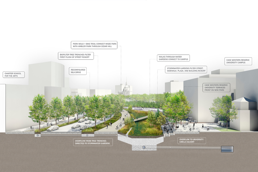
Cleveland is in a moment of profound transition. Following decades of industrial decline, population loss and proliferation of abandoned lots, parts of Cleveland are beginning to come back, guided by sound institutions, a burgeoning health care industry, nonprofit and philanthropic partnerships and local citizens. Initiatives such as Re-Imagining Cleveland have already helped reveal creative solutions […]
Pocomoke Sound Corridor Resiliency Framework
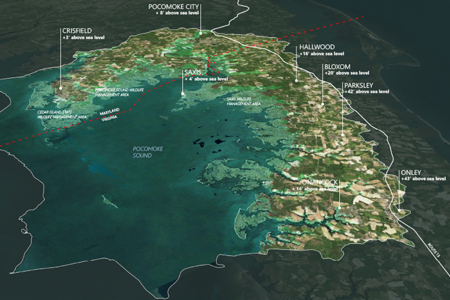
The Pocomoke Sound Corridor Resiliency Framework is a high level, forward-looking landscape scale plan that addresses ecosystem and community resiliency and adaptation as sea level rises and flooding increases within the region. Led by The Nature Conservancy, the Framework Is an important first step intended to spur future phases will incorporate community engagement, identify specific […]
Hunts Point Lifelines
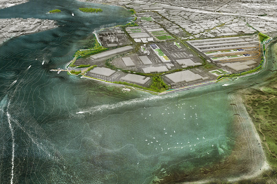
The Hunts Point Lifelines project is an innovative plan to safeguard the hub of New York’s Food Supply through a protective and resilient landscape infrastructure. The plan was a funded winner of the U.S. Department of Housing and Urban Development’s Rebuild by Design competition. The project is an exemplar of design that demonstrates innovative, scalable […]
Origin Park
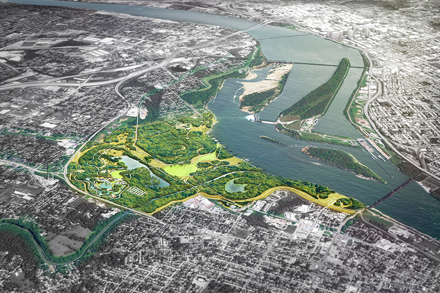
OLIN has been commissioned to develop a design for a new 400-plus acre park in Southern Indiana, along the northern shore of the Ohio River. The project will rehabilitate and transform an expanse of waterfront lands, which for decades have been occupied with landfills and industrial facilities, into a rich cultural and civic asset for […]
Philadelphia 30th Street Station District Plan
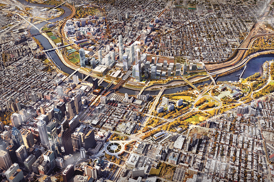
Philadelphia’s 30th Street Station is one of the busiest and most iconic transit hubs in the nation. Its location at the nexus of Philadelphia’s Center City and University City Districts also makes it potentially one of the most valuable real estate tracts. Still, the land surrounding the station is primarily dominated by rail yards and […]
Sepulveda Basin Vision Plan
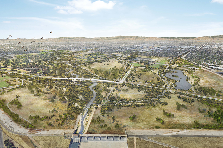
The Sepulveda Basin Vision Plan reimagines the future of the more than 2,000-acre flood basin in the heart of the San Fernando Valley. For the surrounding communities, the basin already serves as a hub for many local recreational activities as well as a biodiversity hot-spot, and a haven for reduced urban heat island effects. The […]
Sojourner Truth State Park Framework Plan for Scenic Hudson
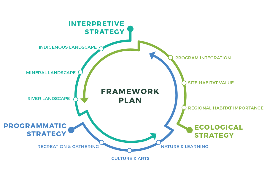
OLIN was commissioned by Scenic Hudson to develop a design strategy for the transformation of a former industrial and mining site into a new 520-acre park in Ulster County, New York, along the Hudson River. The site includes 260 acres of woodlands, more than a mile of Hudson Riverfront offering sweeping views, a dramatic cliff […]
LA River Master Plan Update
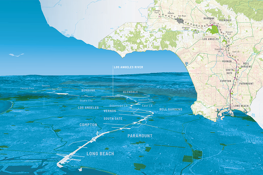
OLIN worked with Geosyntec, Gehry Partners, Street Level Advisors, and River LA on the update of the LA River Master Plan. Through an extensive public engagement process and close collaboration with LA County, the update modernizes the 1996 blueprint and investigates opportunities for recreation, social equity, public health, and flood mitigation. This new, unified vision […]
University of Washington Tacoma 2025 Campus Master Plan
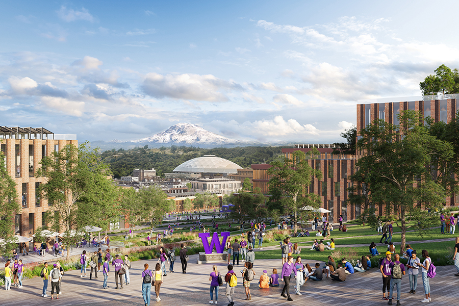
As Consulting Landscape Architects and Planners to BIG Architects, OLIN’s work furthered the University of Washington Tacoma’s mission to cultivate an inclusive, connected academic environment within a complex urban fabric. The proposal and its surrounding landscape integrate the site’s dramatic topography, mobility networks, and regional ecology to create a cohesive campus identity that honors its […]
Benjamin Franklin Parkway Master Plan
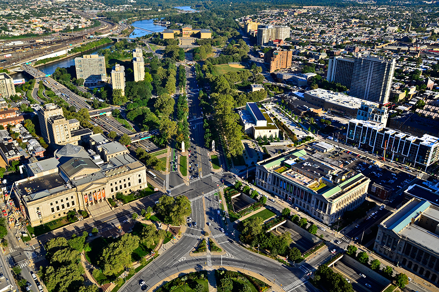
Fueled by the City Beautiful Movement at the turn of the 20th century and inspired by Paris’ Champs Elysees, the Benjamin Franklin Parkway was originally designed as a grand cultural boulevard, connecting City Hall to the Philadelphia Museum of Art. However, lack of subsequent critical development along the parkway and the advent of the automobile […]